“US response to Covid has ultimately been like our response to school shootings: Once we decided unimaginable loss was a price worth paying for an imagined ideal of freedom, the number of deaths ceased to matter. We’d trade a million lives for our need to do exactly what we want.”
Peter Manseau @plmanseau ·
This tweet is spot on. Same is true for human caused climate change brought on by land use change, meat production, and burning up as much fossil fuels as we can.
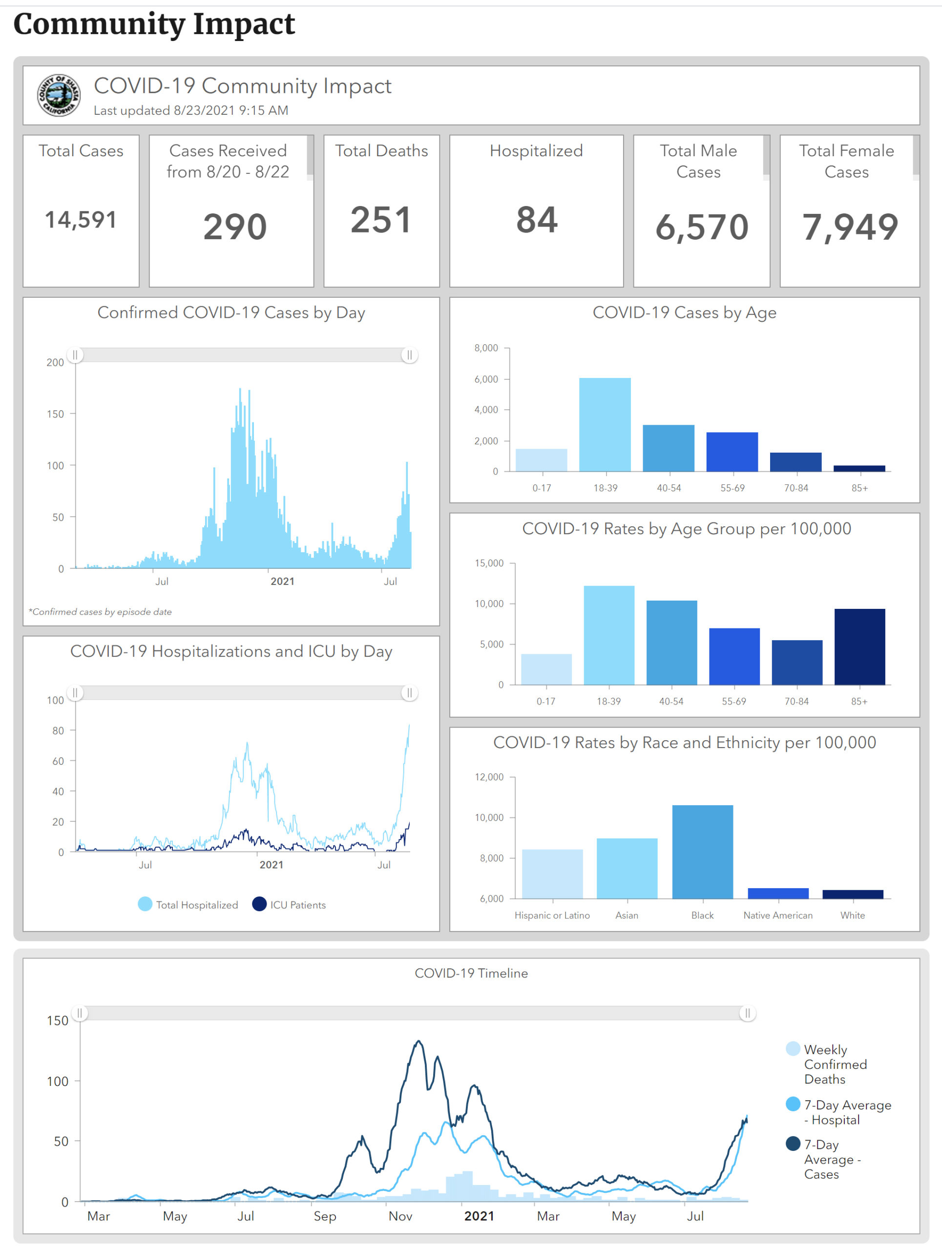
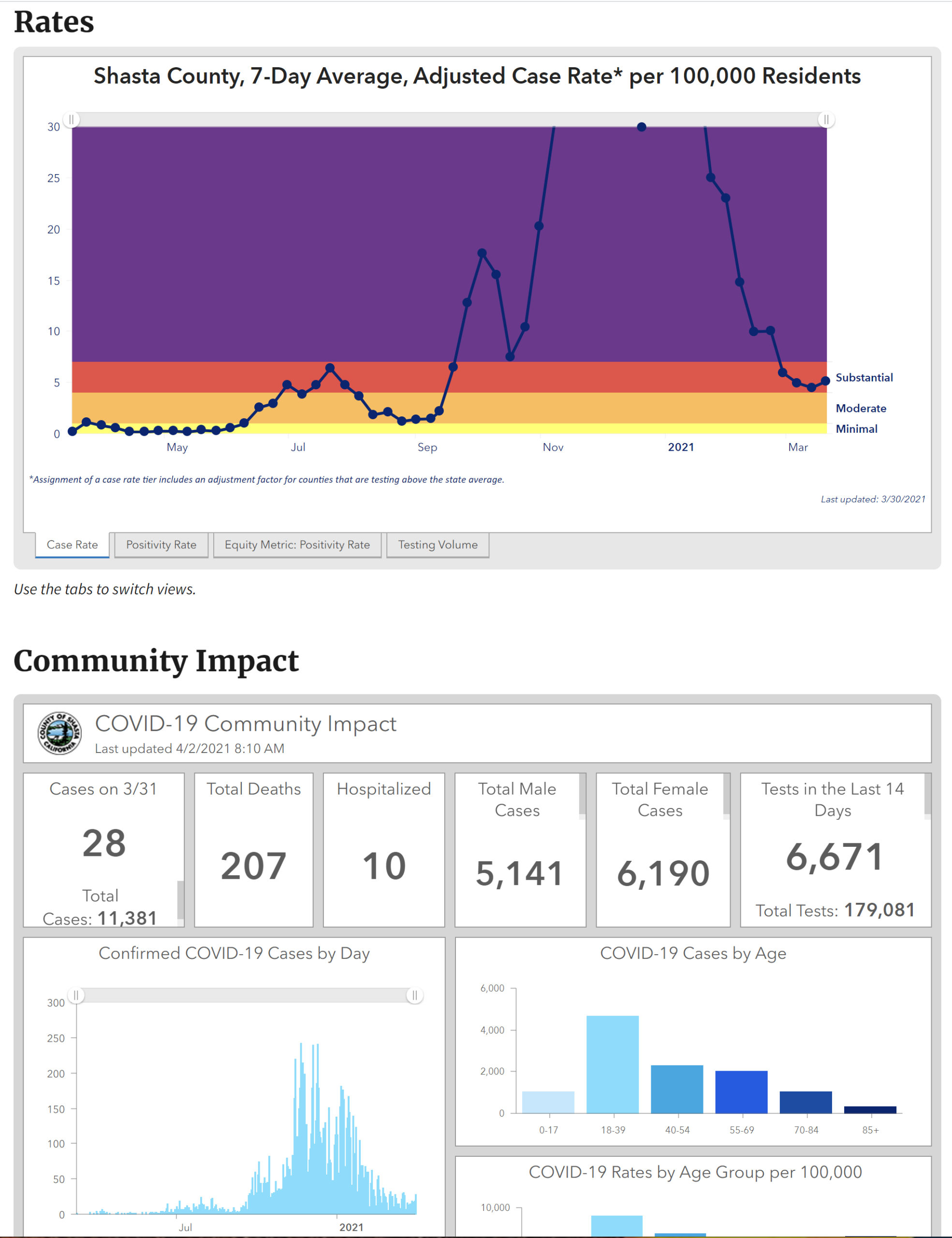
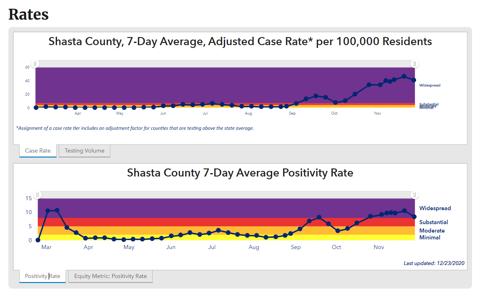
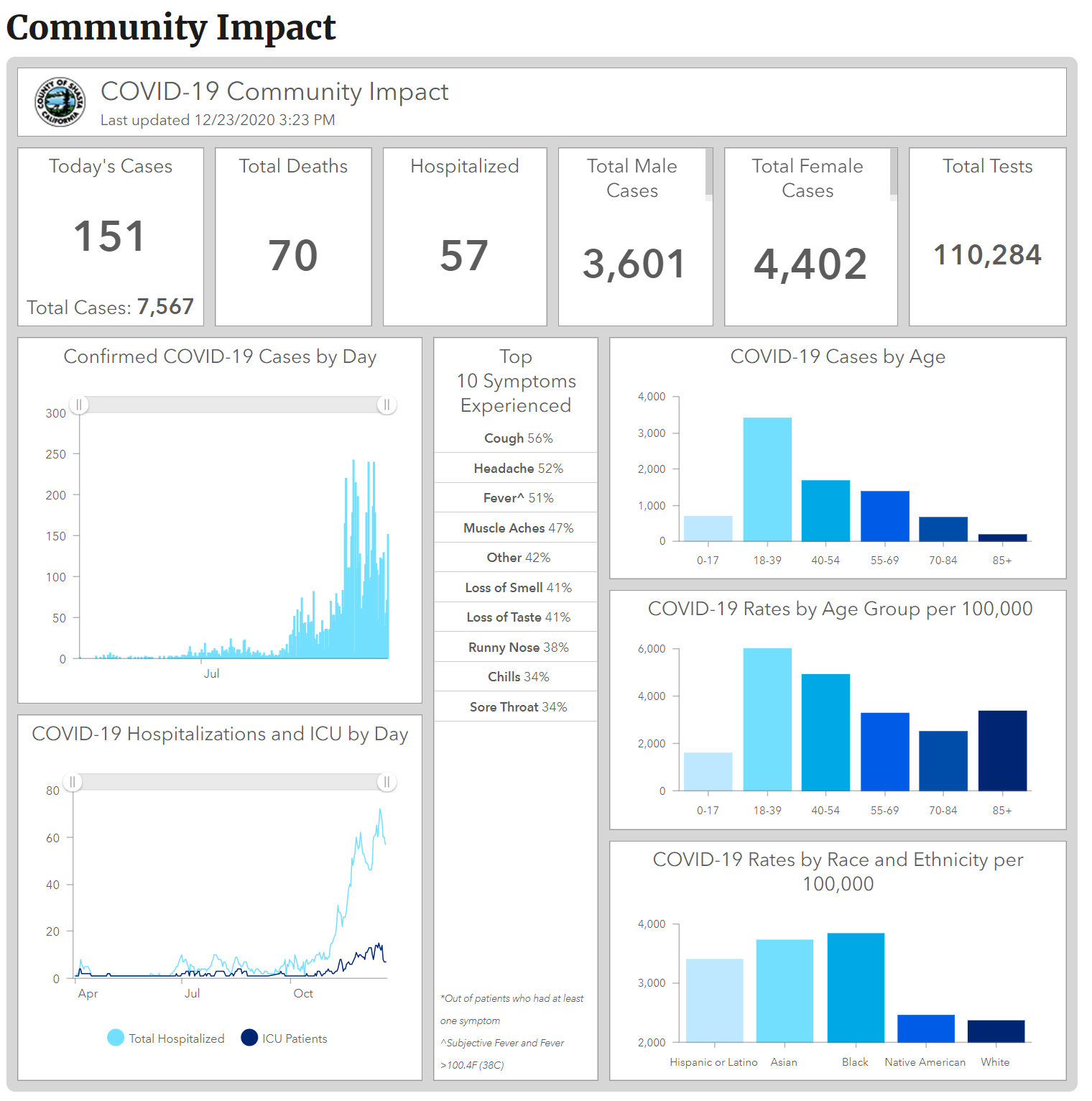
Back when the pandemic first hit in 2020, there was a panicky lockdown. It looked like it could get pretty bad, but nobody knew for sure. It did get bad, especially for frontline medical workers. But then it eased up with increased mask use, and the several excellent vaccines. And then Redding saw a second wave with a more contagious mutation named Delta. You can plainly see it in the graphs:
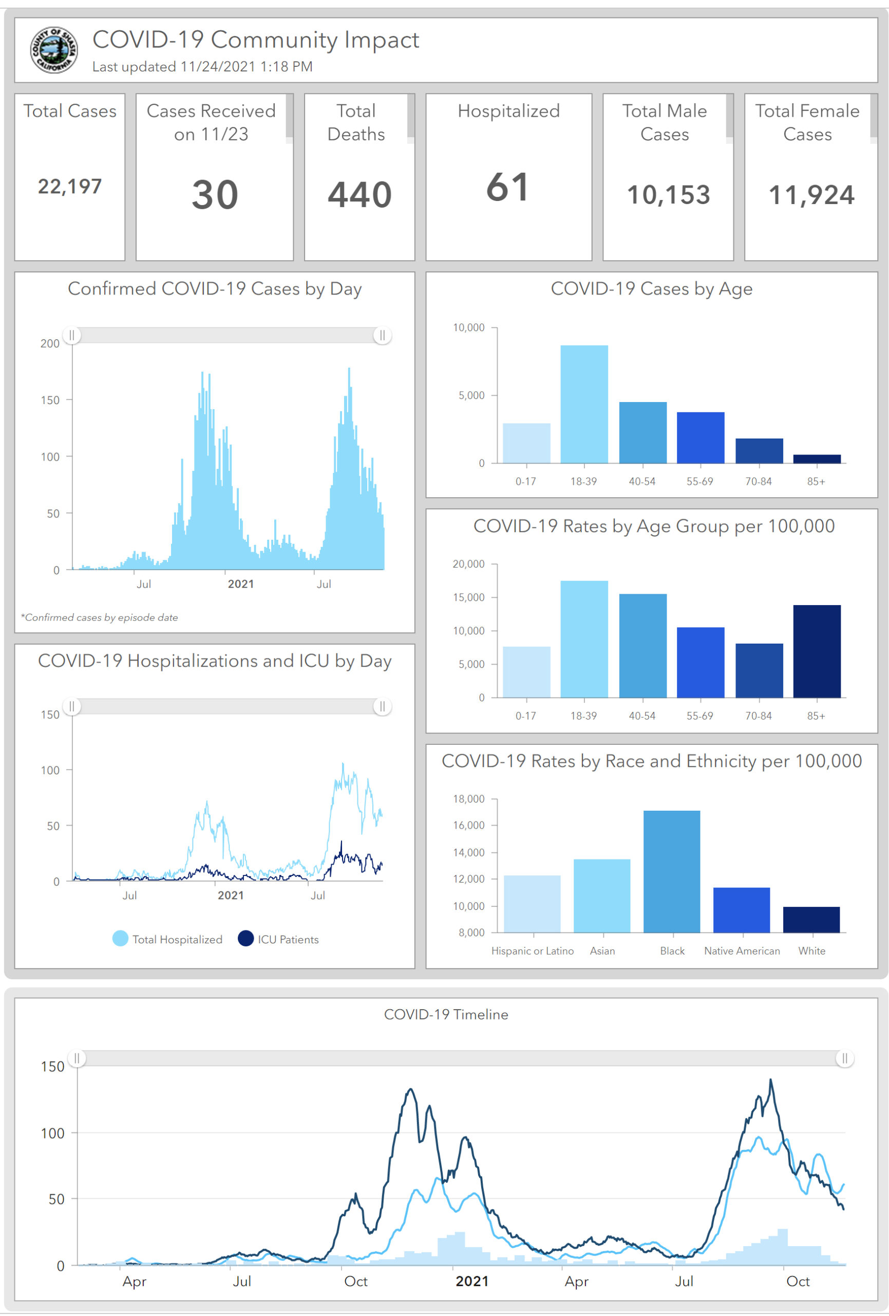
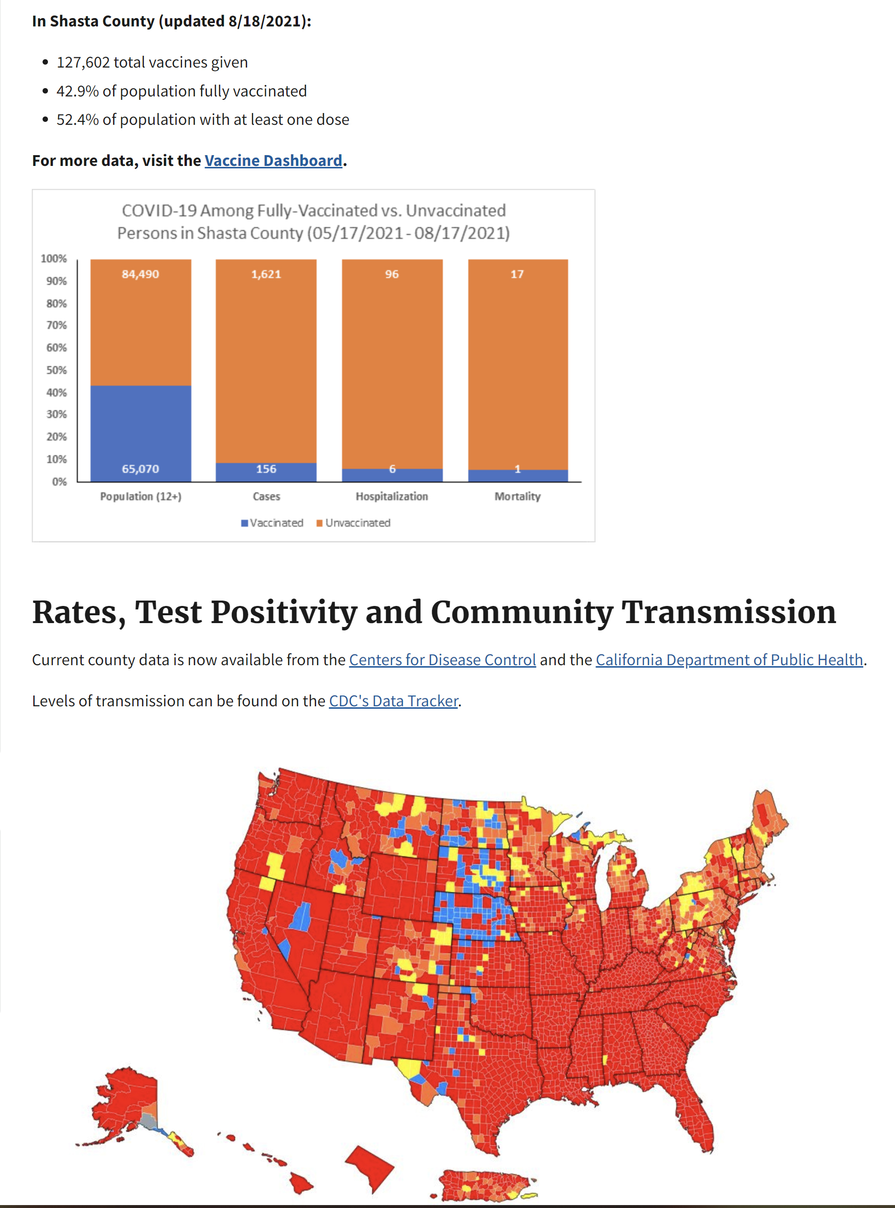
The new variant came, and quickly spread. More people died, hospitals filled up. But then the wave passed, just like the first wave in late 2020. So now there is a new mutation called the Omicron variant. Will it bring us another wave? Well it might, because despite the wide availability of a free and effective vaccine, many people refuse to take advantage of that protection. Health officials literally just shut down the free clinic at the Redding Senior Center because nobody was using it. You can still get vaccinated easily (again, free of charge) at any drugstore. But the local ratio of vaccinated to unvaccinated population has remained about the same as it was before the last wave, with predictable results:
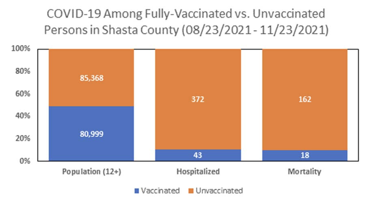
So the virus still has lots of opportunity to continue to spread and further mutate among the unvaccinated population.
“Once we decided unimaginable loss was a price worth paying for an imagined ideal of freedom, the number of deaths ceased to matter.” Yep. Oh, and there was another school shooting today, and 3 kids are dead. I suppose this is just normal life now. Get used to it.