A quick overview of Keswick Dam on the Sacramento River in February 2025. High flow conditions are currently flooding the the low lying area around the river in Redding and Anderson.
Keswick Dam at high flow – Sacramento River
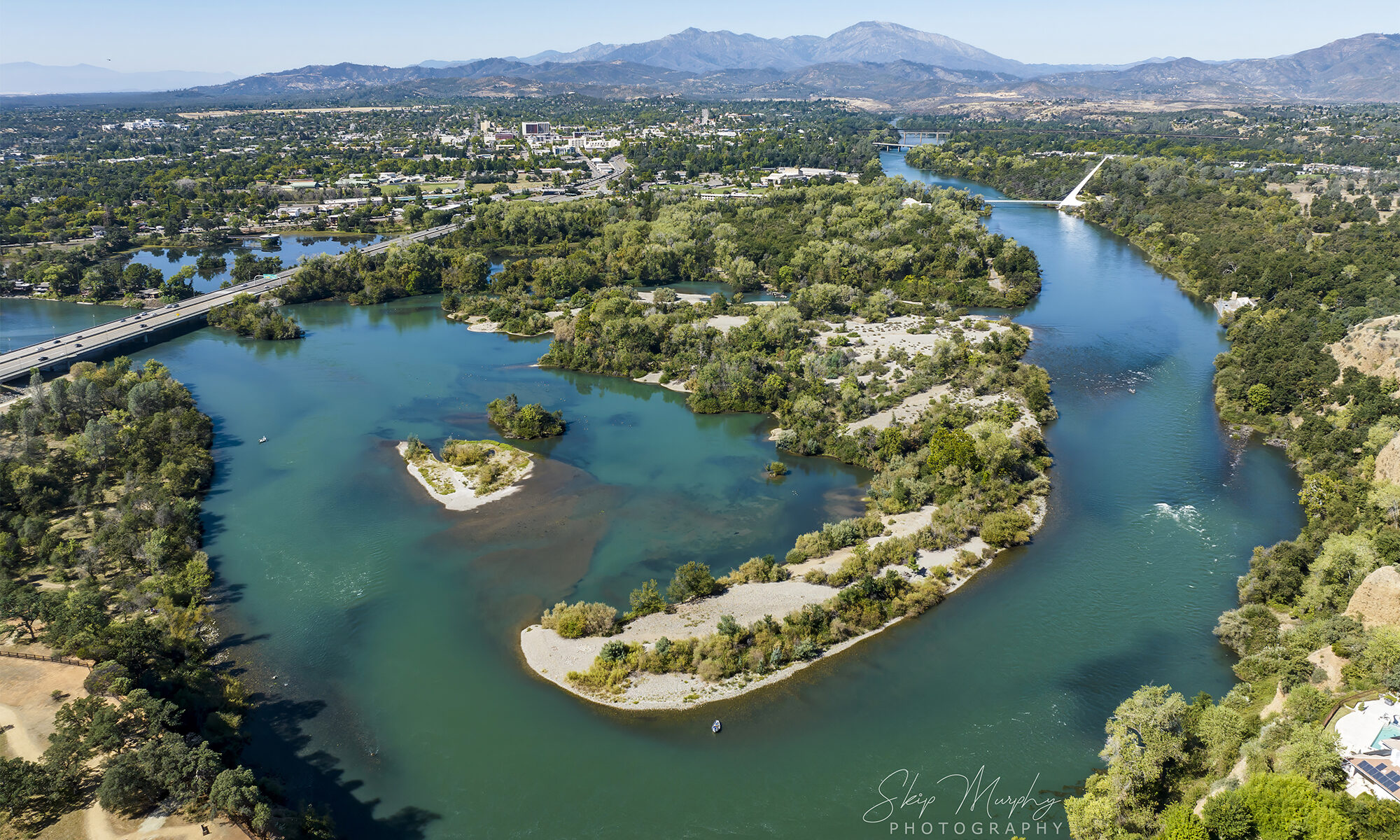
Life and all in Redding California
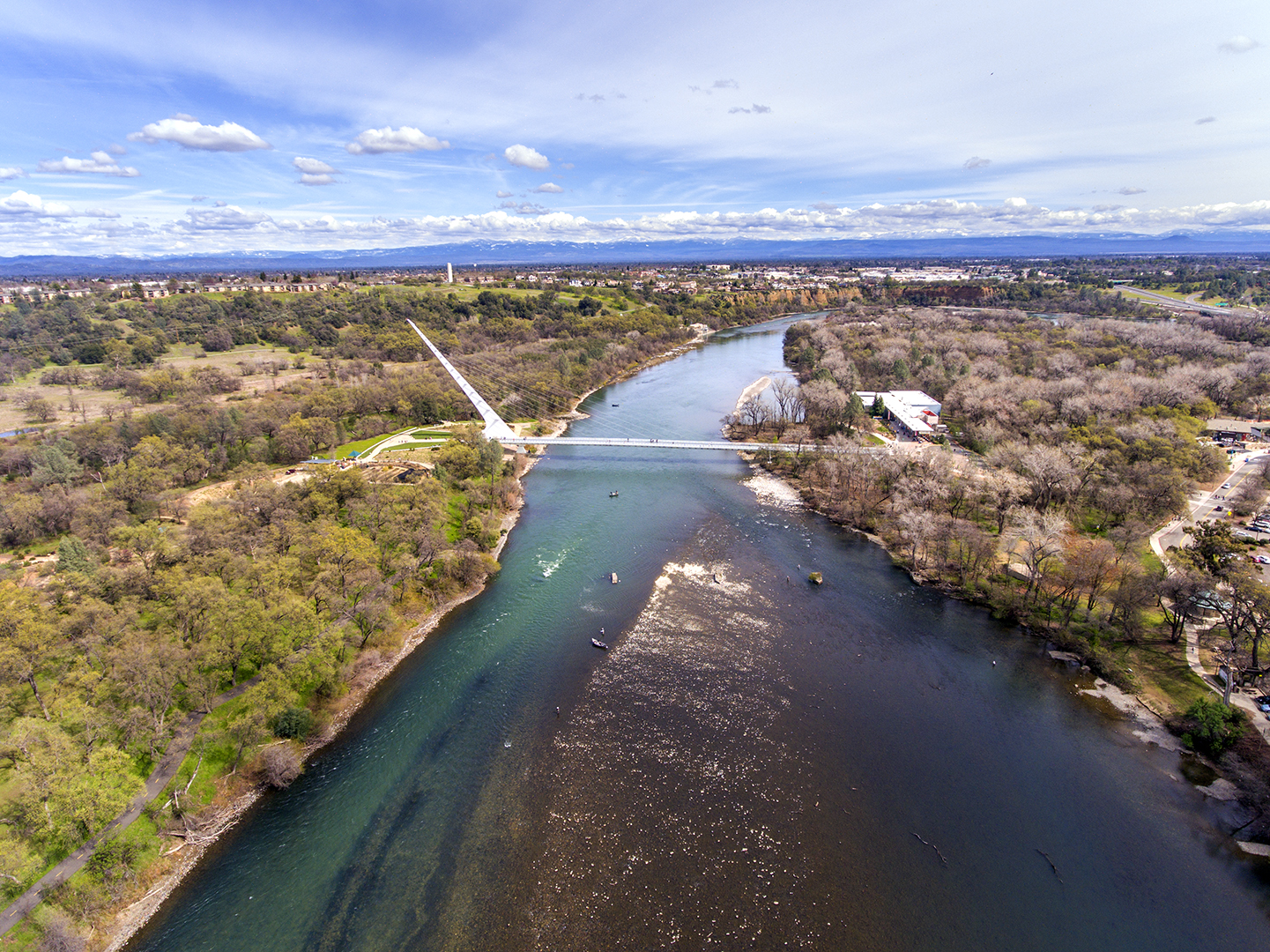
Here’s a soothing flight overlooking the Sacramento River as it passes through Redding California on its way to the sea. The devastating Park Fire rages into the fragile and crucial Mill Creek drainage of the norther Sierra. One of the few remaining un-dammed Salmon runs for protected spring run fish. Truly awful events taking place to the east provide a a golden and smoky light to Redding. Pretty, but deadly.
Video capture and editing by Skip Murphy. Soundtrack by me and Craig Padilla.
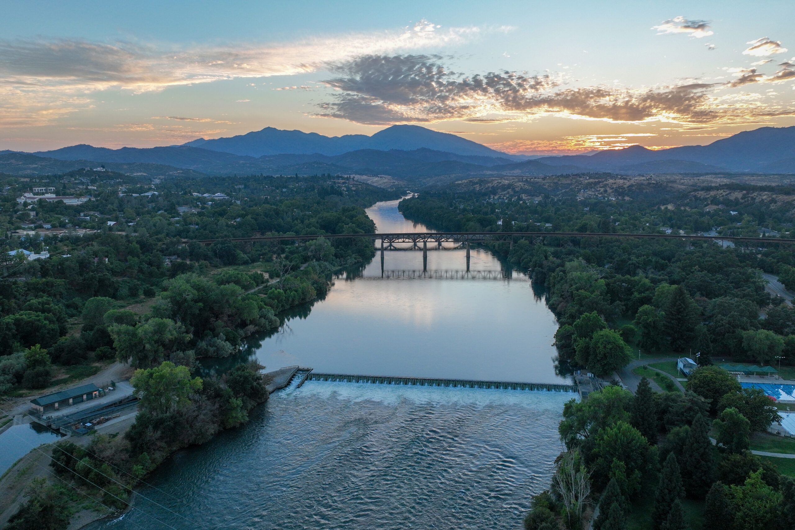
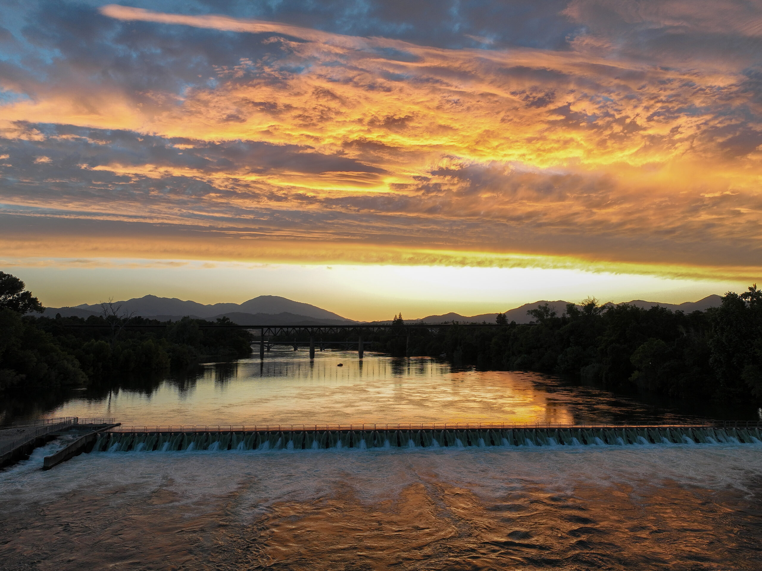
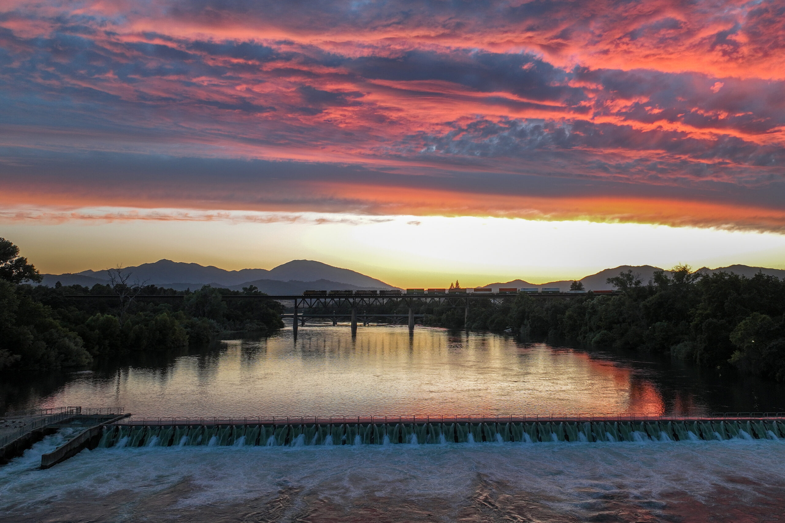
Lake Redding forms when the Anderson Cottonwood Irrigation District raises a wooden dam across the Sacramento River at Caldwell Park. The resulting weir supplies the old irrigation canal feeding the homes and farms to the south. There is a fish ladder. Drift boats ply the lake. The water is very cold, as it comes from the bottom of Shasta Dam.
I was getting set up to do a time lapse, but was not in the position I had planned. They sky turned gold and I popped the drone up anyway, so as to not miss the peak. It wasn’t what I planned, but it turned out very nice. The river is flowing east, toward the drone. The clouds are flowing north. Then, a southbound train crosses the river on the trestle. A boat is seen. All of it very nice.

Hike Redding! Image captured during a break in the weather on a January day from above the Hilltop Dive trailhead to the river trail. This section of trail gets plenty of use. You can park on Hilltop and be rewarded with a pleasant aerobic walk down to the river and back. Click to enlarge:

Here’s the trailhead on a sunnier day.

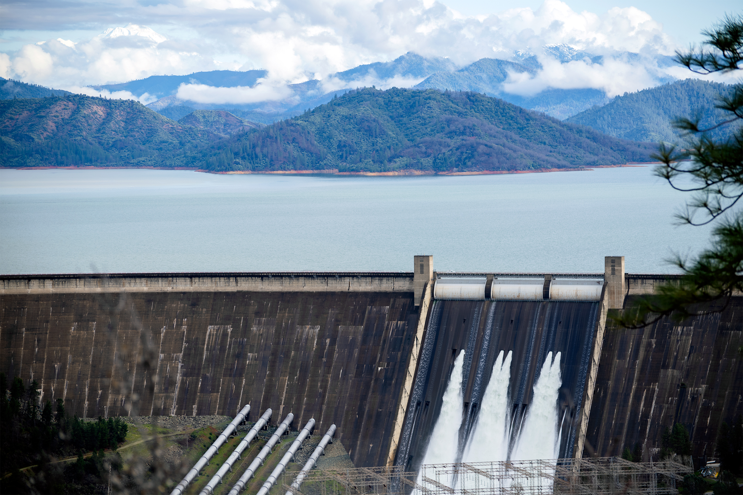
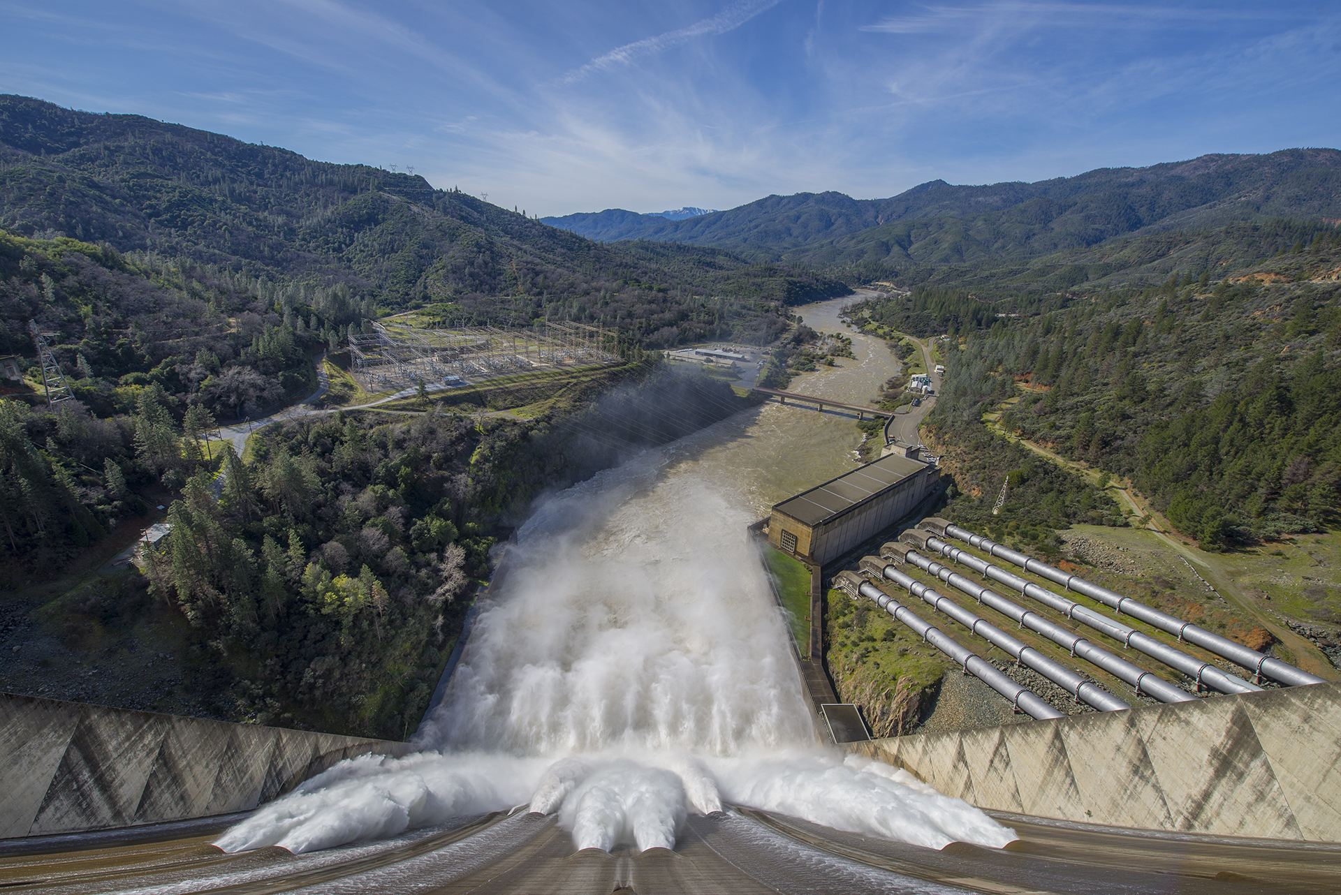
A series of views of the Shasta Dam spillway running at high water release I captured on Feb 12 2017. This water flows into the Sacramento River. I believe the flow was around 70,000 cubic feet per second at this point.
I think this was about the same time that state officials became seriously concerned about the Oroville Dam. Shasta looks solid, though. Click to enlarge:
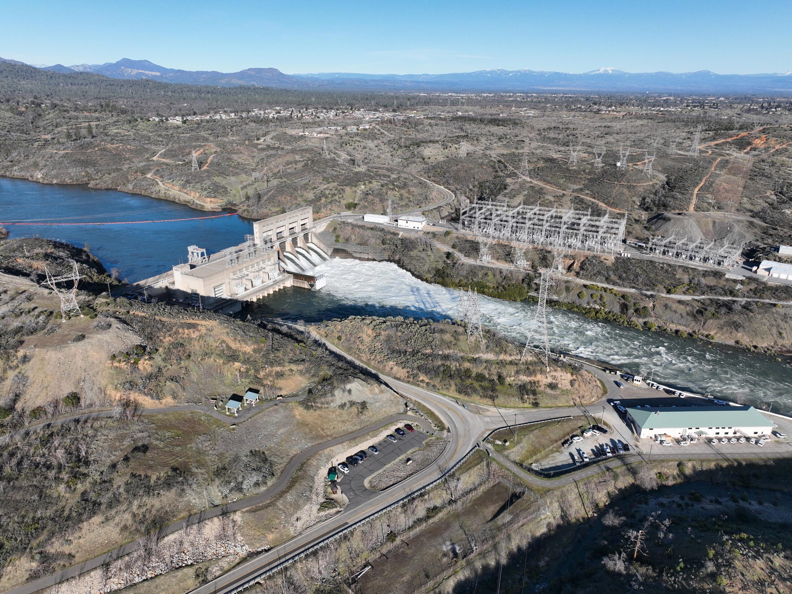
A TV station in Medford Oregon called and asked permission to use my footage of the Shasta Dam spillway, which I found to be gratifying. I asked them to attribute it to Really Redding.