
Brief flight over redwood canopy to the sea
Redding artists Craig Padilla and Marvin Allen release new music!
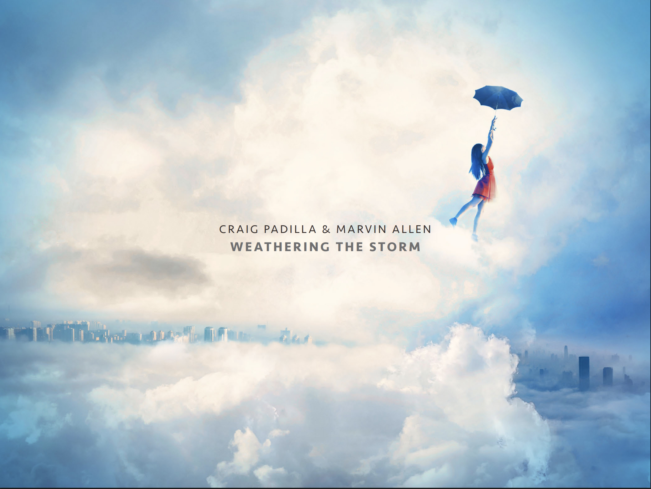
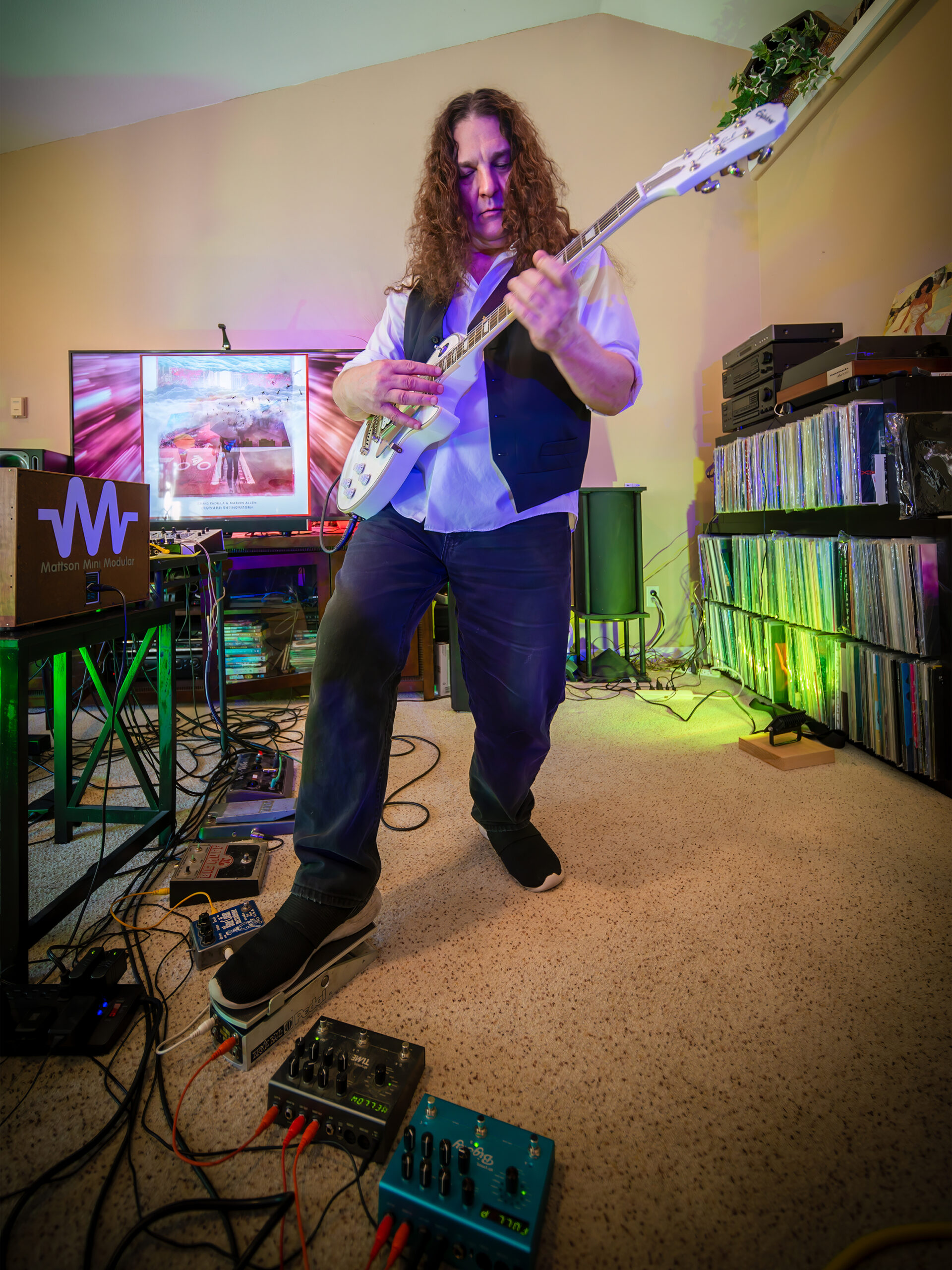
Redding-based Musicians Craig Padilla & Marvin Allen Intensify Their Electronic Post-Rock Journey on ‘UNFOLDING SKIES’
Unfolding Skies is a continuation of the themes developed in our first three albums and another chapter in the many strange environments encountered by the Umbrella People on their journey.” — Marvin Allen
REDDING, CA, UNITED STATES, February 20, 2026 — Spotted Peccary Music artists Craig Padilla and Marvin Allen reunite for their fourth release Unfolding Skies, bending the ambience and turning up the intensity of their three previous collaborations into an electronic post-rock sound that pulses and shimmers like the stellar nightscapes that inspired it. The album releases worldwide today and is available on the streaming platform of your choice at https://orcd.co/unfolding-skies.
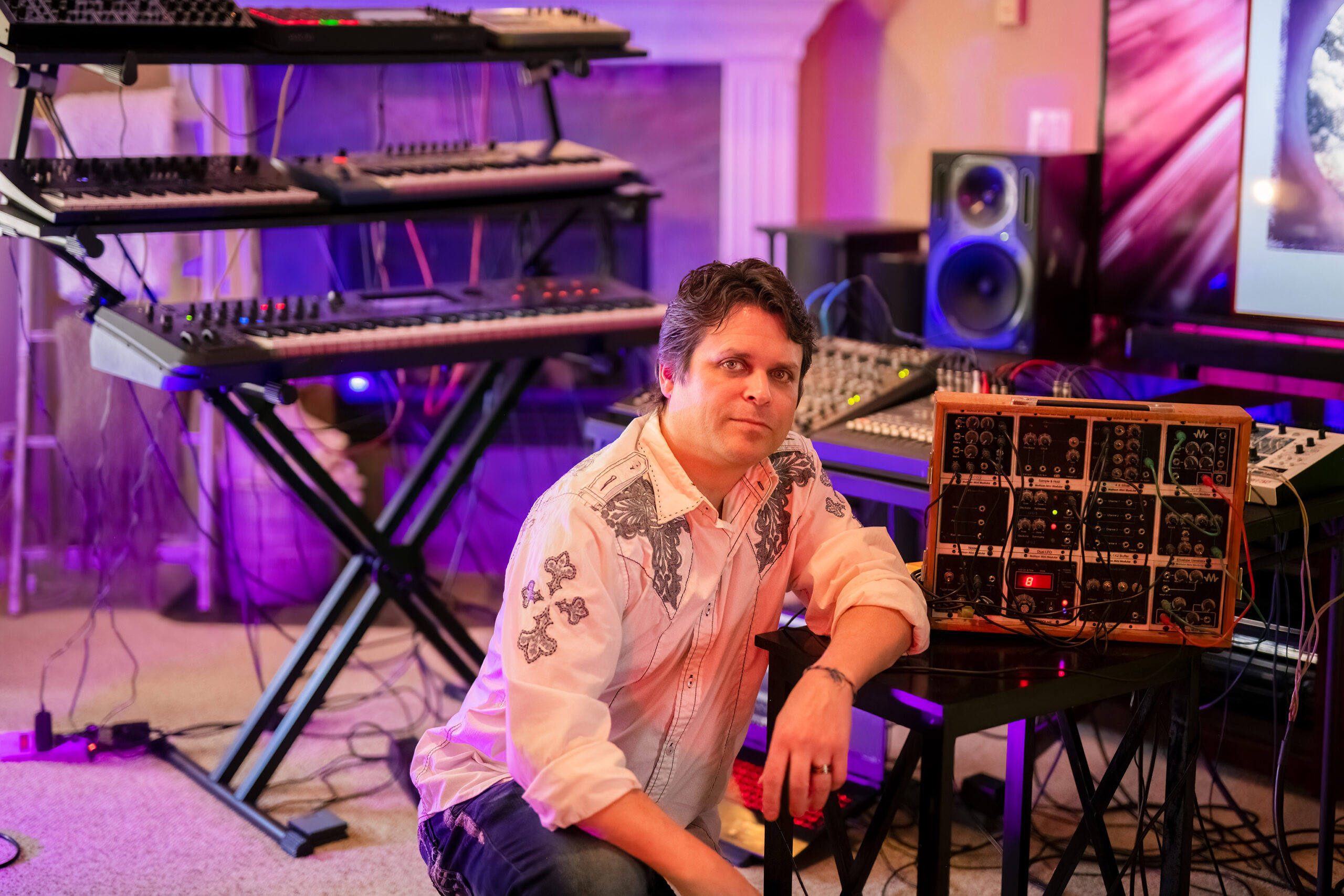
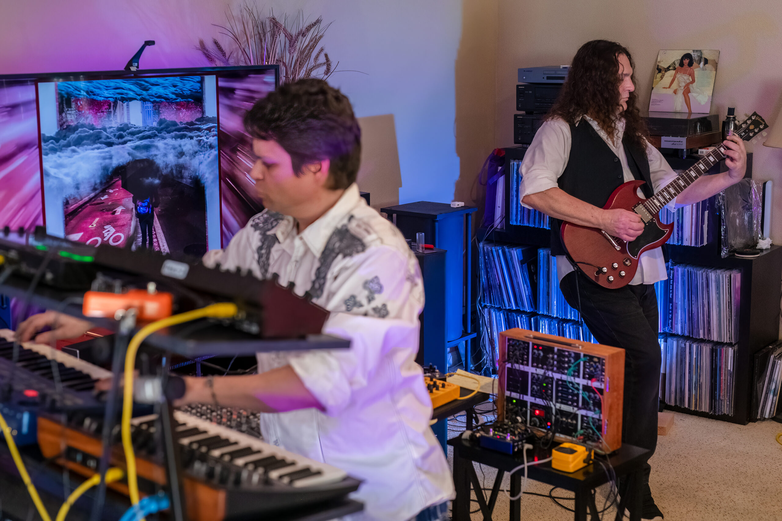
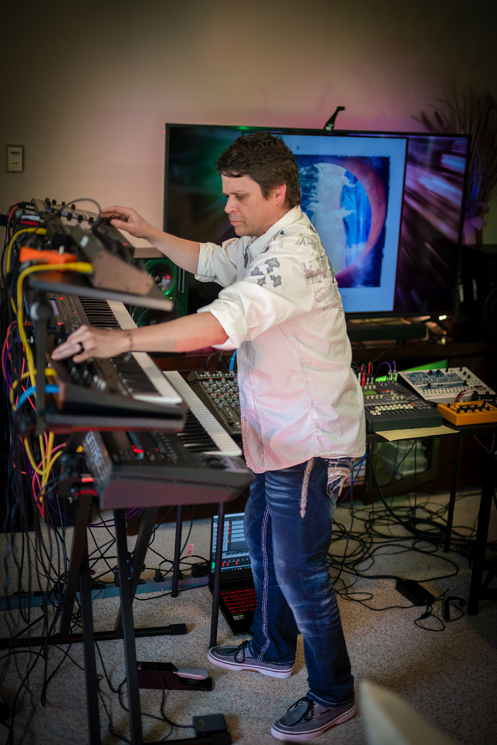
On this project, Padilla and Allen meticulously crafted Unfolding Skies into an amalgamation of sound expressiveness. This live approach brings Allen’s guitar work centerstage through Padilla’s electronic landscapes, blending familiar tones of classic rock, ambient and prog into something new.
“Unfolding Skies has a more straight-forward approach with Marvin’s guitar work, meaning that it’s more of his actual performance without the use of additional overdubs,” Padilla thoughtfully states, noting that in the past they used a technique of composing material through live studio improvisation, extracting vibrant elements, defining structure and perfecting the musical conversation. The difference is palpable.
Focus tracks for the album include “Jammin’ with Buddha,” “Undercurrents of Change” and the epic “Architects of Time,” in which Allen’s fiery guitar blazes a trail through film score panorama and space rock pyrotechnics. Padilla’s swirls of synth and guitar complement one another throughout the album, evoking listener references to Alan Parsons, Vangelis, Tangerine Dream and Robin Trower, who is one of Allen’s inspirations.
All of Padilla and Allen’s collaborations have featured the “Umbrella People” in the album artwork as a representation of everyone trying to find their way of existence in the chaos of the world. Unfolding Skies is the next step in that journey, but even bolder and brighter than before.

Starting in 2019 with Toward The Horizon, followed in 2021 by Strange Gravity, then Weathering The Storm in 2023 and now Unfolding Skies, which is available as a CD and in digital formats for streaming and downloading, including high resolution studio master formats. Listeners may select the format of their choice at https://spottedpeccary.com/shop/unfolding-skies/

New CD available now on Spotted Peccary Music, perfect for fans & playlists of Prog / Classic EM / Berlin-School / Atmospheric / Post-Rock music.
The album was mastered by Howard Givens at Spotted Peccary Studios, NW, Portland, OR; creative direction by Daniel Pipitone at Spotted Peccary Studios, NE, Ligonier, PA. Spotted Peccary owns a vast catalog of over 200 albums for easy licensing to TV, Film and commercials.
Catch the curated relaxing ambient electronic 24/7 LIVE STREAM – SPMLive: 24/7 Ambient Electronic – https://linktr.ee/ambientelectronic.tv
For artist interviews, reviews, or promotional requests, please contact Beth Ann Hilton via beth@spottedpeccary.com.
Tracklist:
1 Framework 12:03
2 Undercurrents of Change 05:28
3 Sun Portal 05:58
4 Jammin’ with Buddha 05:14
5 Cosmic Blueprint 08:38
6 Architects of Time 05:37
7 Unfolding Skies 13:20
Links:
Smartlink: https://orcd.co/unfolding-skies
Spotted Peccary Album Page: https://spottedpeccary.com/shop/unfolding-skies/
Bandcamp: https://padilla-allen.bandcamp.com/album/unfolding-skies
Instagram: https://www.instagram.com/spottedpeccary/
Facebook: https://www.facebook.com/spottedpeccary
About Craig Padilla and Marvin Allen:
Craig Padilla and Marvin Allen are an international award-winning electronic ambient-rock duo from Northern California whose music combines expressive musicianship with deep atmospheric sound design. Padilla, a veteran of the electronic music scene with over 40 releases, is known for crafting immersive soundscapes using analog and digital synthesizers. Allen, a seasoned multi-instrumentalist, performer, and music educator, brings decades of experience in recording, film scoring, and mentoring young musicians. In addition to being released on the world-renowned Hemi-Sync label (through Spotted Peccary Music), their collaborative works have charted at NUMBER 1 for numerous weeks on the NACC Charts, have been commissioned by Star’s End Radio, and have also been featured on Sirius XM, nationally syndicated programs Echoes and Music from the Hearts of Space, as well as many other radio programs and podcasts. https://spottedpeccary.com/artists/craig-padilla-and-marvin-allen/
About Spotted Peccary Music:
Portland-based Spotted Peccary Music is North America’s finest independent record label with a focus on deep, vast and introspective soundscapes. For over four decades, the artists of Spotted Peccary have been on a mission to develop, produce, publish and release ultra-high-quality, deep-listening experiences that engage the listener and exceed expectations. Every release is carefully prepared in a variety of high-quality formats from MP3 to high-res studio masters. In 2023, they were named Best Independent Record Label by the HIMAwards. Explore more than 200 titles and 50 artists released over 40 years of excellence. Explore perks of the 40th Retrospective celebration at https://spottedpeccary.com/spm40/ and shop for a collectible music $20 Discovery Pack while supplies last at www.AmbientElectronic.com
Beth Hilton
Spotted Peccary Music
+1 310-560-8390
email us here
Visit us on social media:
LinkedIn
Bluesky
Instagram
Facebook
YouTube
X
Other
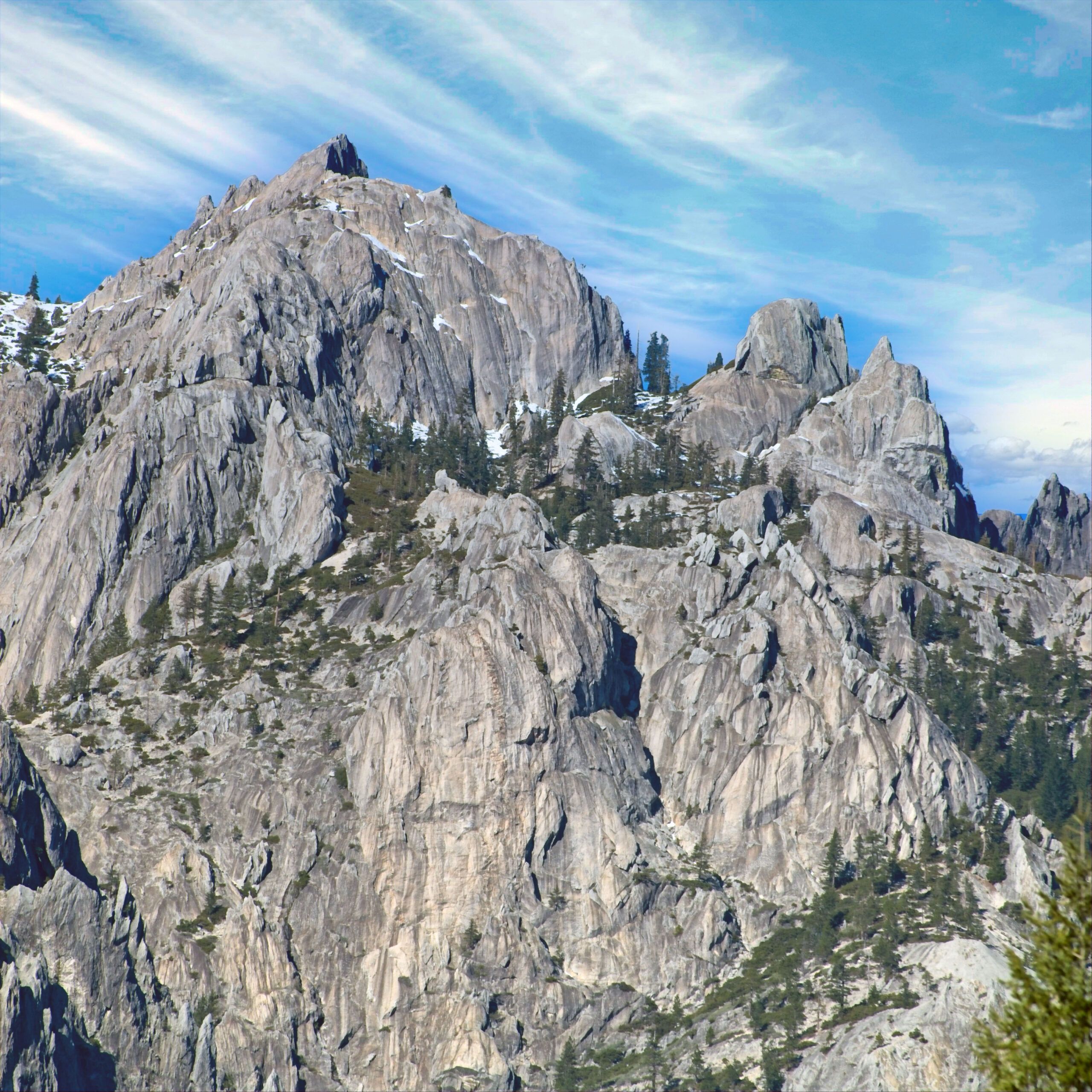
Castle Crags on MLK Day 2026
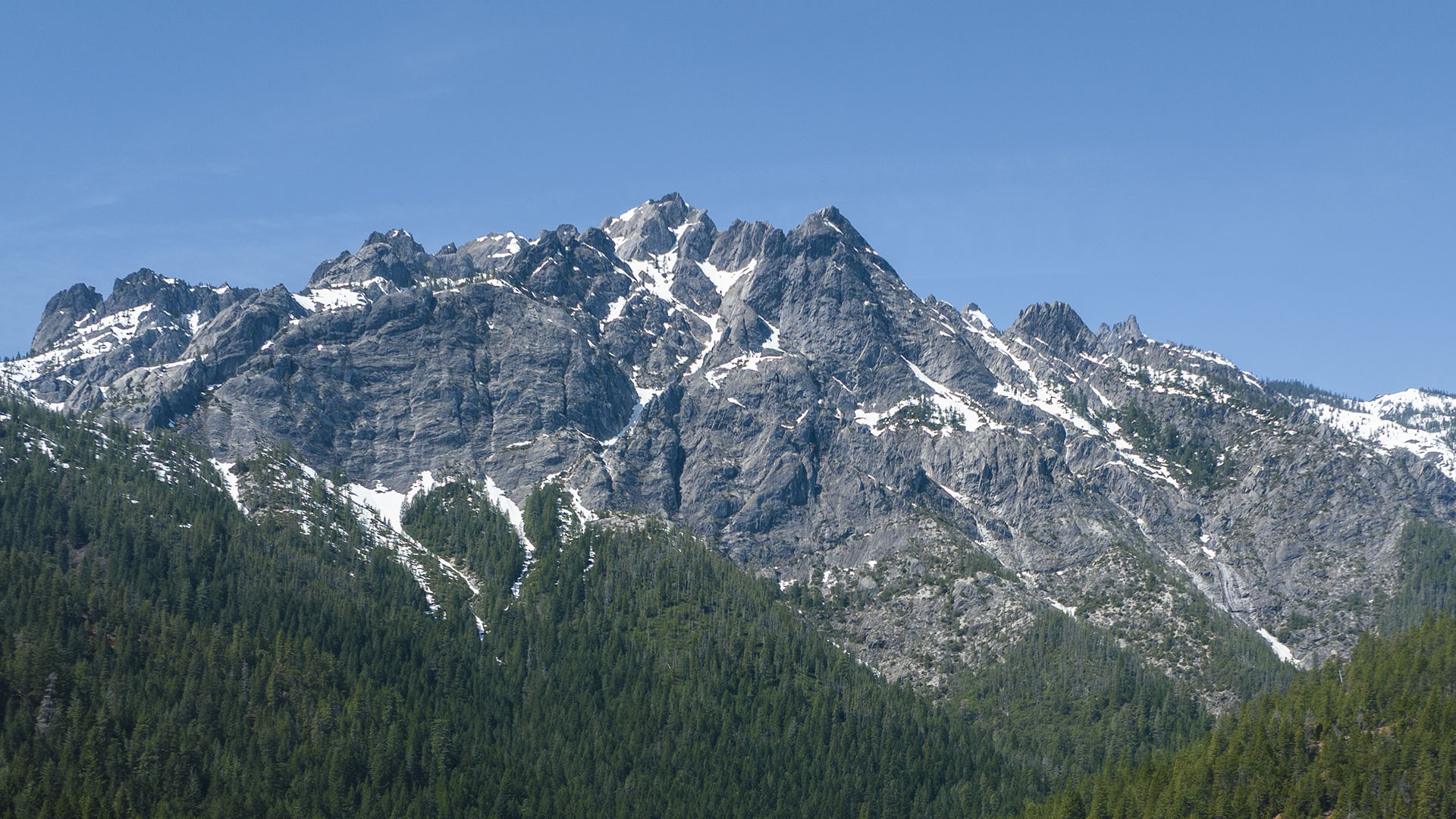
Admission to Castle Crags State Park in Castella was free for the January day we celebrate the life of the Reverend Martin Luther King Jr. I captured some images.
“The arc of the moral universe is long, but it bends toward justice”.
I hope so. Things look bleak in the moral universe lately.
Here is a 360 view taken from just outside the park.Click on the image to look around:
This wonderful park is less than an hour’s drive north of Redding. The campground is small, and it all seems understaffed. It wasn’t crowded that day, even though it was free to get in. It’s only around $8 on any normal day anyway, I think. But it would be unfortunate to see it overwhelmed by some viral social media post. That does indeed happen. One must be careful what one posts, but I don’t know how to entirely avoid that calamity that without just keeping it a secret. It is very beautiful in any event. A lovely hike or picnic spot that’s ReallyRedding.
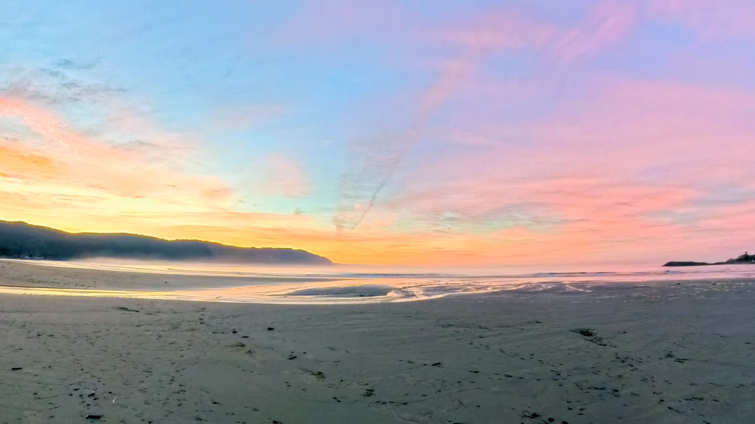
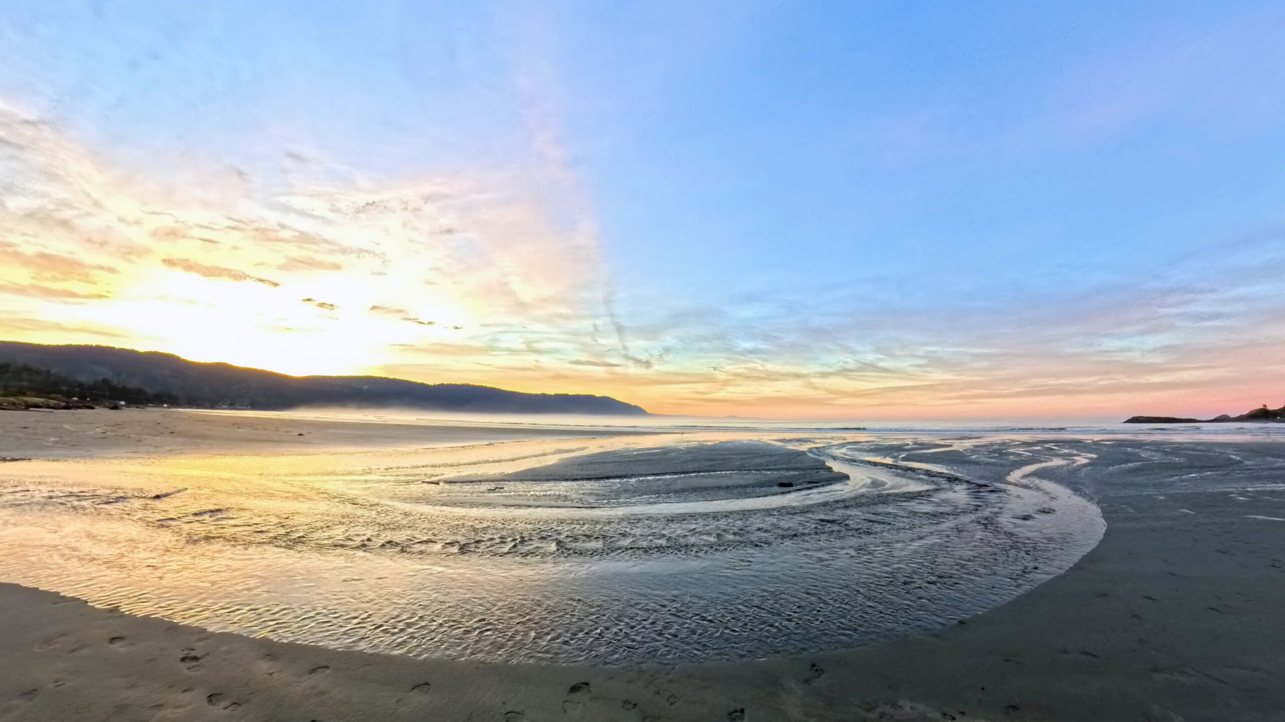
November Sunday morning in Crescent City
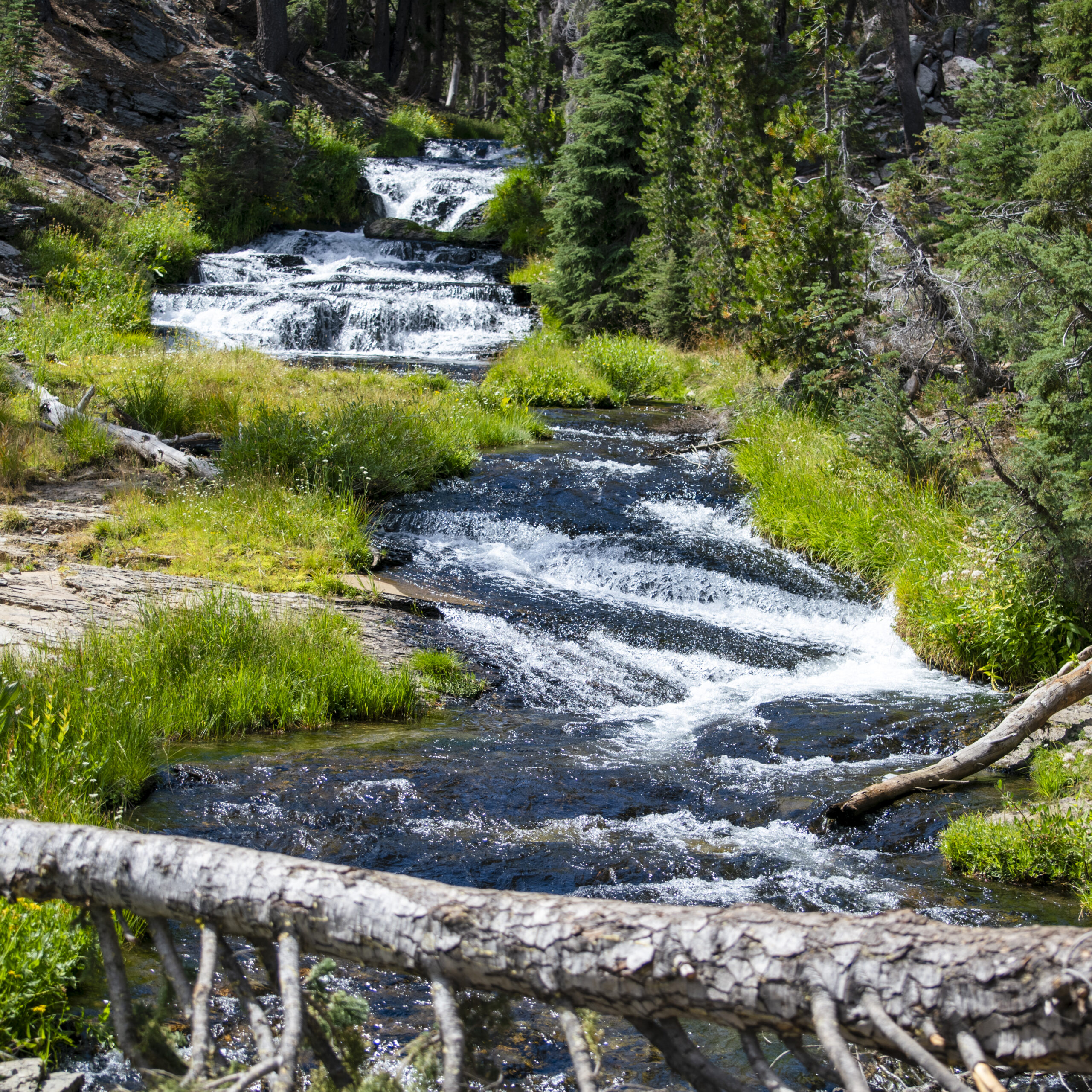
Kings Creek Falls
Shasta Rowing Association and Redding
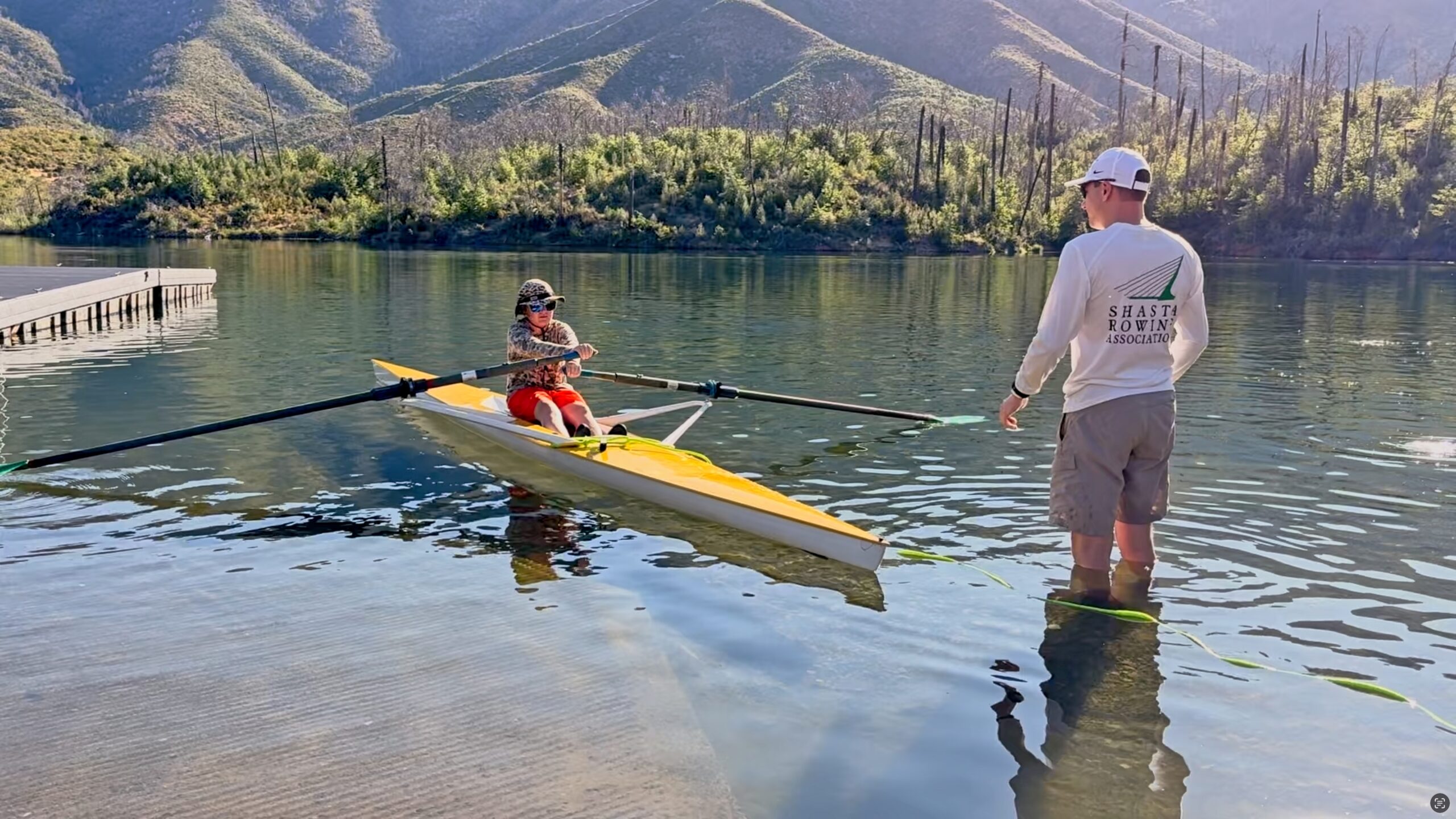
Shasta Rowing Association member instructs young student on Whiskeytown Lake. Image taken ata recent class put on by Redding Recreation. A lovely and healthy skill taught in a truly spectacular setting. While there we all witnessed an eagle swooping in to catch a fish, too quick for a photo.
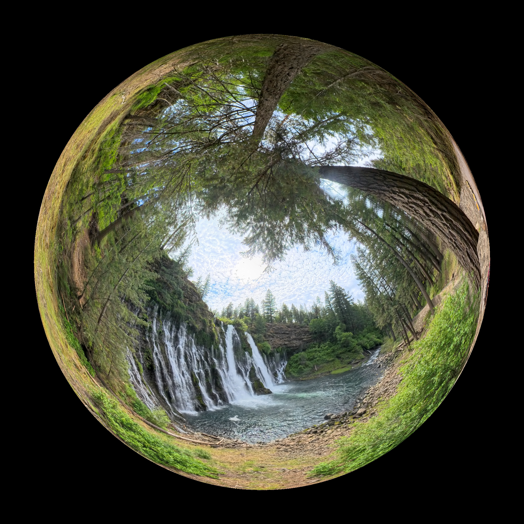
A renewed Burney Falls
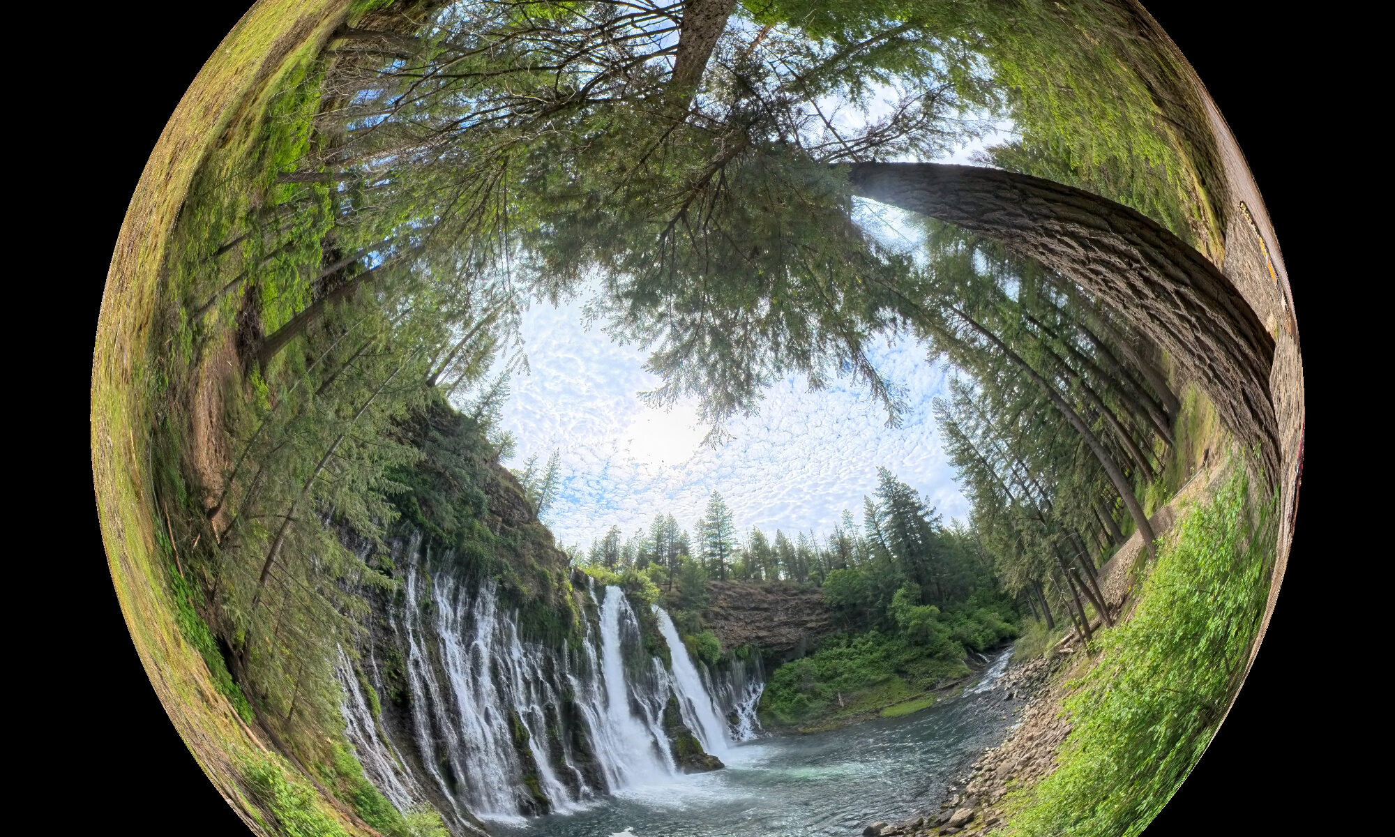
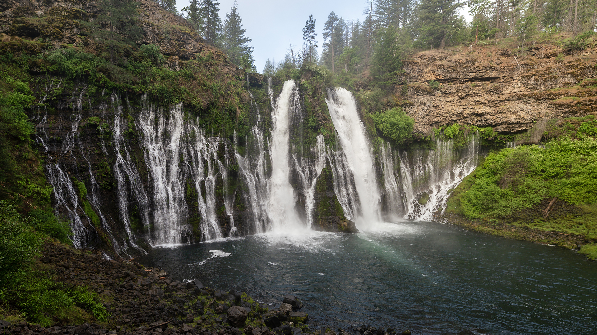
Well, not a renewal of the falls itself, instead the trail down to the falls has been massively redesigned and improved. But first, here’s the famous falls in action:
Sure, you’ve seen that view before. This year, it’s really flowing strongly due to our recent fairly normal wet winter. Well, heavy winter rainfall used to be normal. No matter what, the water you see here flows from an underground aquifer. Not far upstream from the falls, the creek bed is nearly dry.
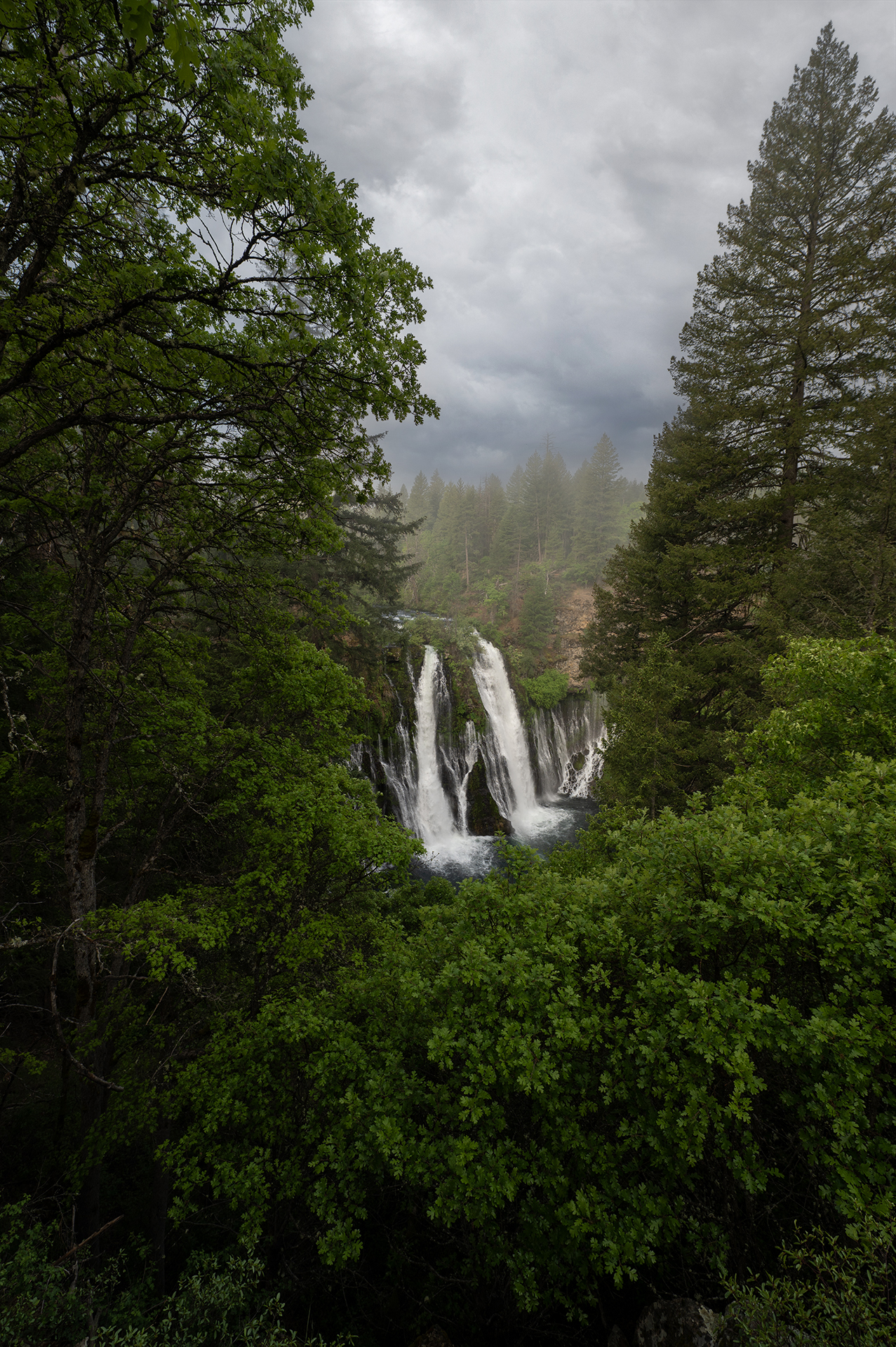
Here’s your first glimpse of the beauty as you approach:
A couple more shots:

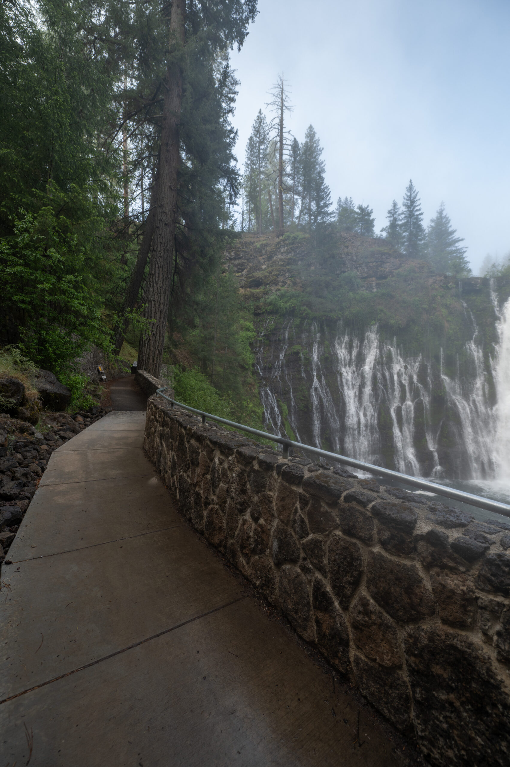
The new trail work is amazing. It looks really authentic, and is in keeping with the forestry style. It’s like something from Yosemite or Yellowstone. It also looks like it’s always been there. If you’ve been there in the recent past, you may recall when the trail was more of a “suggestion.” Cutting corners and scrambling over loose rocks invited the adventurous and foolish city folk to injury. Not great for a park with as many tourists as this one attracted. Yes, the trail is cleaned up and well defined (with handrails!). More civilized, but, still in keeping with the woodsy ethos. I say it’s a big improvement.
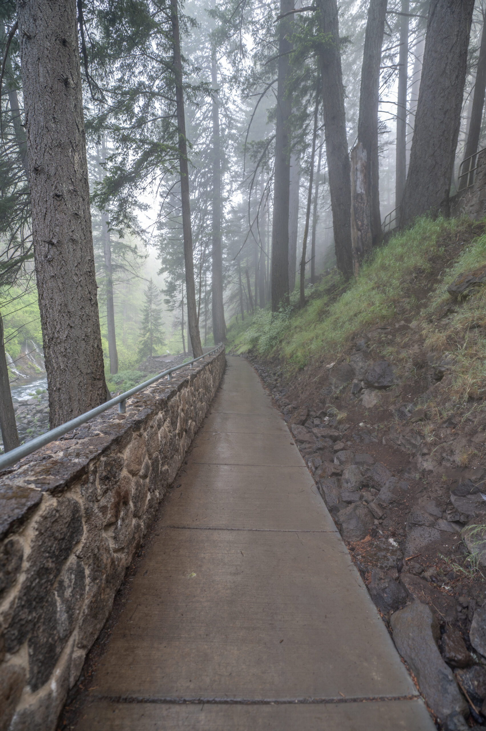
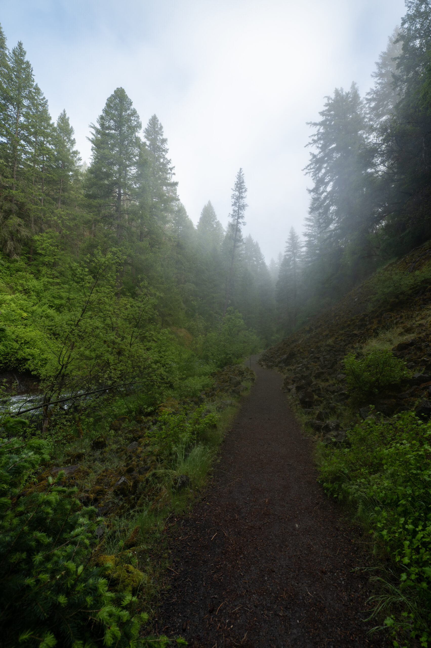
There are still more rustic trails:
We camped in the Rim Trail campground. It was lovely, quiet and serene.
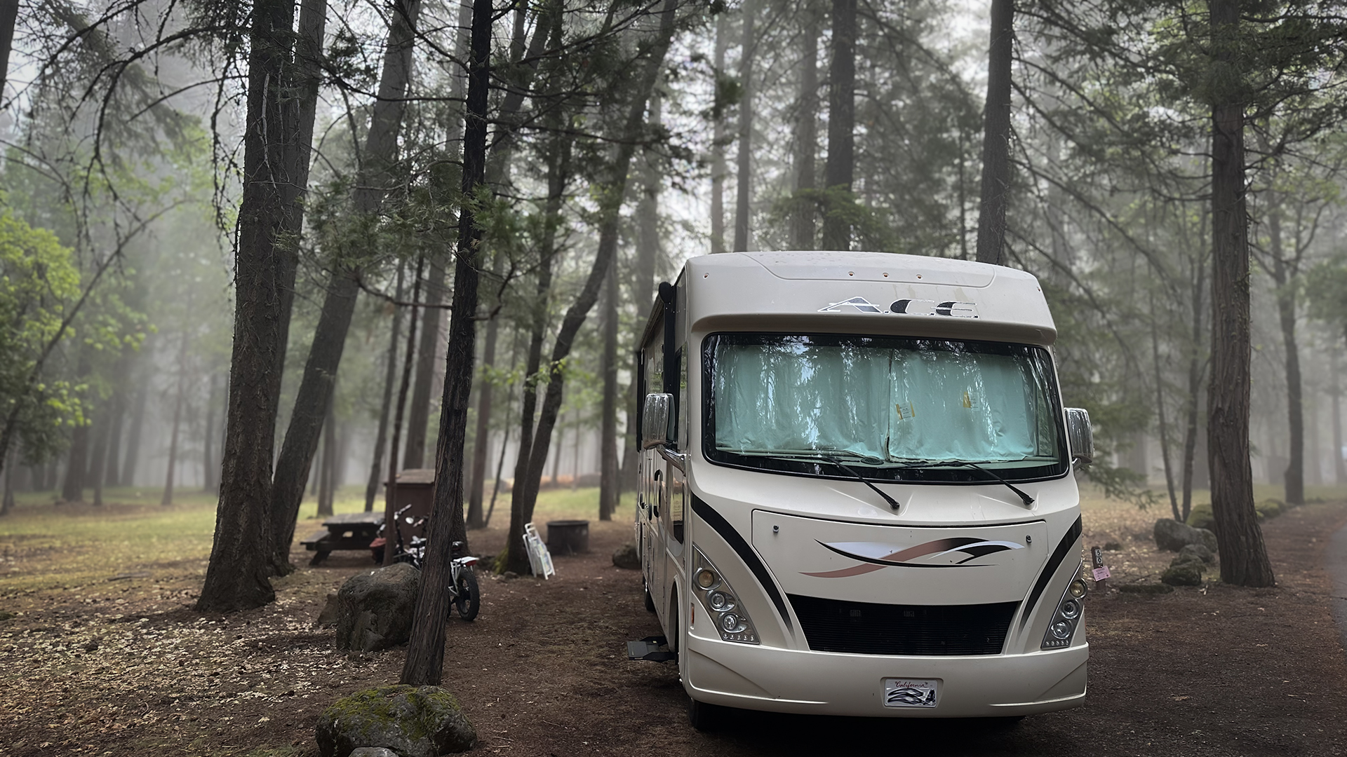
No hook-ups. No electricity. No wi-fi. No cell service. At first it was bit of withdrawal for me, I’m sad to admit. Then, it became a sublime respite. An unexpected break with a positive impact. Highly recommended. But good luck to you getting here. We are told the campground is fully booked for the summer of 2025, and they start reservations 6 months in advance. But there we are. Just like Yosemite, etc. park popularity comes with a downside.
A few more images:
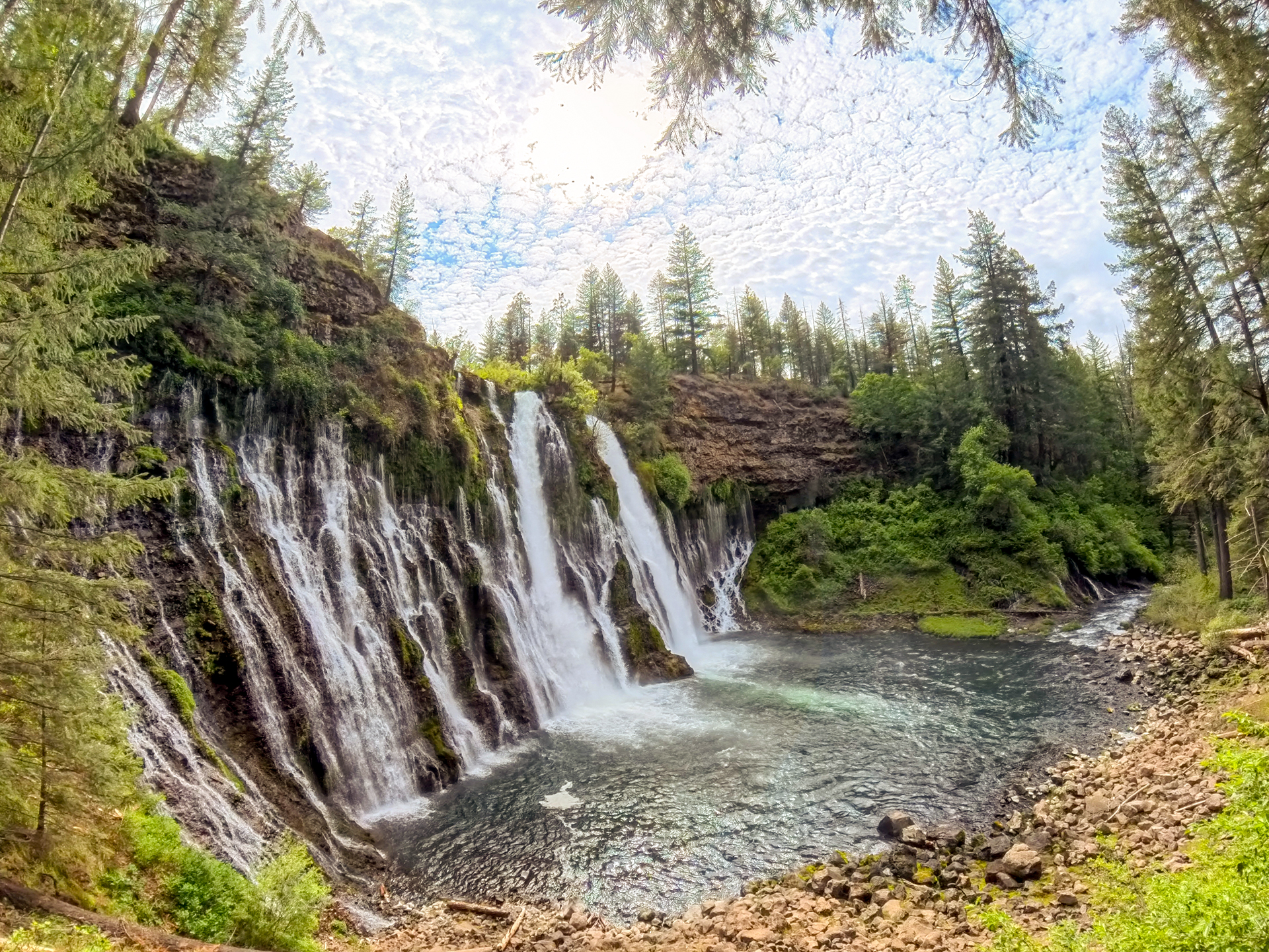
Burney Falls State Park is located about an hour’s drive east of Redding on highway 299E. In so many ways, it’s ReallyRedding.
Approaching Mt Lassen

The often snow covered vista of Lassen Peak graces our eastern horizon from Redding California. I can see the mountain from my bedroom window in north Redding. Here is a brief aerial view captured in the spring of 2025 approaching the park from the west.
